 |
 |
Installment #3 - April 19, 1999 - Mount Laguna
I'm at Mount Laguna, which is about 42.9 miles into the trip. Doing great! Again, yesterday was another hot day, but no problem at all. I camped using the tent for the first time last night. My only problems so far are that I lost my flashlight yesterday, and this morning I went to put my shorts on and broke the "tie thing" around my waist, so if I lose weight I'm going to have to figure out some way to hold my pants up (Heh-heh-heh!).
Mount Laguna is at 6000 feet. We saw our first snow - the snow started at around 5800 or 5900 feet but just little teeny patches of it. As a matter of fact, from where I stand now I can see a little bit of snow, but it's not going to last long. It's nice and warm - it's in the 80's.
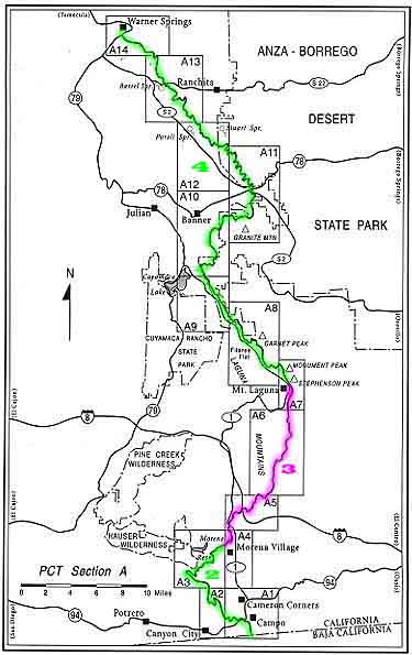
If you're following on the map, I'm now at Map A7, which is where Mount Laguna is. The next call will probably be Friday - that's when I hope to get into the next stop, which is Warner Springs.
Again, I'm doin' it, lovin' it, havin' a great time!
Allen
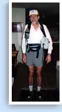
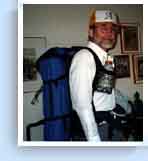
Here are a couple of photos that arrived in today's mail, taken the day before they left home in Mountain View. Allen's in the midst of a dress rehearsal for the trip, all packed and ready to go. The water bottle holder was fashioned by one Rita Assisi. The gray bag under Allen's left arm holds a warm jacket. Allen's ham radio is on his right hip, and the pouch holds his camera, map, snacks, etc. Click on the thumbnail for a larger view.
|
|
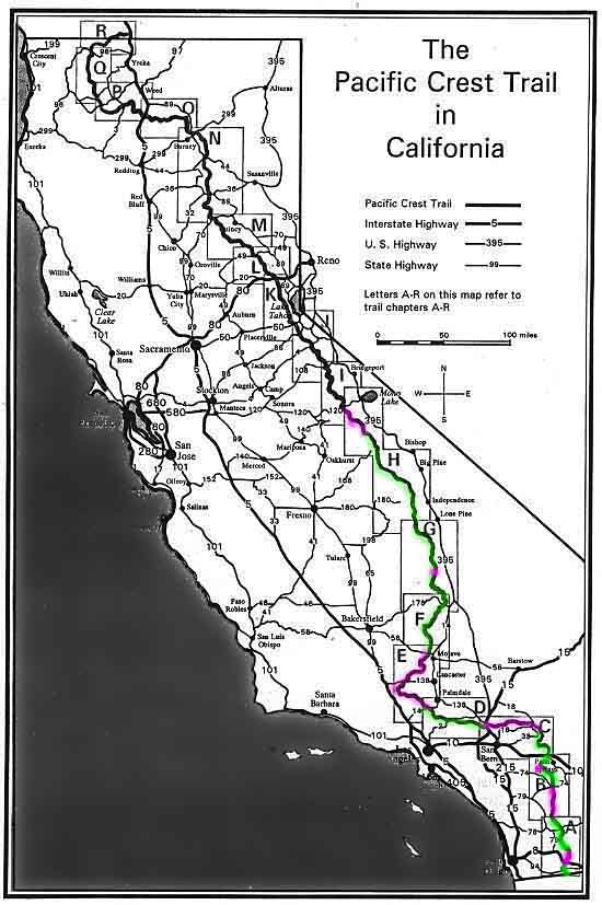
Be sure to check Allen's progress on the freshly updated Chapter Map, which provides a close-up view, and on the California Map, which shows the entire state. The rectangles on the California map are lettered A through R, and these refer to the trail chapters.
Dave
Added from scans of Allen's slides on May 8:
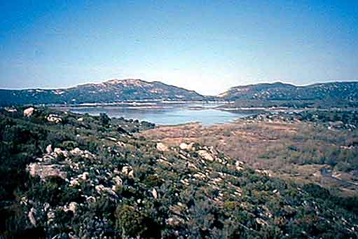
Looking back from the PCT on Lake Morena
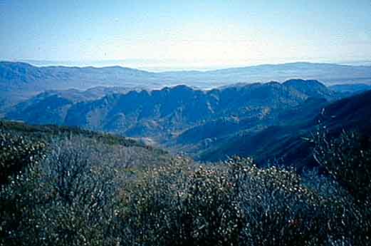
Anza Borrego Desert from lookout just south of Mount Laguna
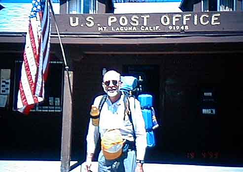
Allen in front of the Mount Laguna Post Office
![]()
![]()
![]()