Installment #14 - June 5, 1999 - Kennedy Meadows!
I'm in Ridgecrest, CA, which is southeast of Mount Whitney and an hour or so from Kennedy Meadows.
The last call was Friday night from the hotel in Tehachapi. On Saturday morning I had a big breakfast, and then Terry Larson, who is the PCTA representative in the area, came and picked me up at the hotel and took me back to the pass, where I started hiking again. I hiked by hundreds of windmills - literally hundreds! And not just in that immediate pass, but over the next 30 miles or so. Wherever there was a windy ridge, it was loaded with windmills. The trail in many instances goes right by some of them, and I got to look at a lot of windmills up close.
My plan for this segment, again because of my feet, was to hold my mileage down to 18 miles a day. That first day I did 18.9, which was pretty good. But then the next day, I missed the landmark that was going to mark the end of my day, and when I figured out where I was, I had gone 22 miles or so. I wasn't very far from Robin Bird Spring, a water supply, so I hiked to there, making it about a 25-mile day. That was Sunday
Then Monday was into the desert for a 35-mile dry stretch, so I was carrying water for a couple of days - a real heavy pack, hot desert, miserable. I reached a point around 7:00 where I just couldn't go any further. There was no place to camp, and I ended up taking out my trowel that I used to dig cat holes and smoothing out enough sand to lie in. [Now I really wish I'd gone with him.] I stayed there until about 2:30 the next morning. Then I got up, packed up, and headed out around 3AM to take advantage of the full moon and hiking in the coolness.
So I got a lot of trail covered up until around noon of the next day, when I stopped again in a meadow near McIver Spring. I laid out my sleeping bag and slept from noon till 3:00 that afternoon. By that time, clouds had come in and it had cooled down, and I got up and continued on to a campground at Walker Pass. That completed Section F, and that was a 27.2-mile day.
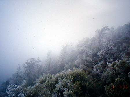
Then on the next day, it was up past Mount Jenkins. I camped in a pass, so it was up pretty high, and the clouds were blowing over the mountain at that point, and we were actually camping in the clouds. I woke up to frost inside my tent. [Now I really, really wish I'd gone with him.] Then I hiked out and it was really beautiful - almost like being back in winter again. The clouds had frosted up the trees - one side of all the trees was white, and when the wind blew, the frost got knocked down out of the trees onto the trail, almost like snow.
The previous day, I had caught up with "Little Bear", a hiker from Oklahoma who owns a $5000 house and pays $18 a year taxes, and so can afford to spend lots of time hiking. I also met a hiker named Shoshana, a girl from Washington State who has built her own cabin, 20'x12', out of scrap material on her friend's property. Her rent is to help maintain the property. Her love is hiking, and she started the trail at Agua Dulce in order to do some desert and plans to hike to Sierra City, or however far her $200 will take her.
Anyway, Thursday and Friday were both easy days - less than 20 miles each day. I arrived in Kennedy Meadows [named after JFK's lesser-known yet just-as-sordid affair with Audrey Meadows] around noon yesterday (Friday) and went to the Kennedy Meadows General Store. They didn't have much variety, but I bought myself a loaf of bread, a package of salami, a package of cheese, a package of potato chips, a couple of quarts of milk, a half quart of chocolate milk, a couple of Cokes, and a can of luncheon meat like Spam. I read the labels and figured out that I'd just bought something over 7000 calories. I made six or eight sandwiches and ate them all - tasted pretty good to me!
My friends Jan & Dan arrived early and picked me up this afternoon. We are staying in a motel in Ridgecrest tonight, and will drive home tomorrow. A few days R&R, then back on the trail!
Allen
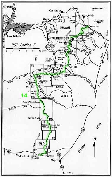
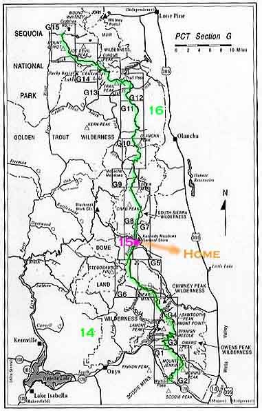
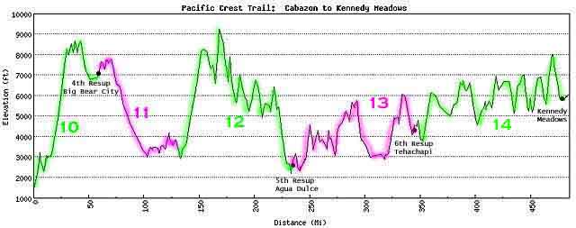
Our ambulatory gourmand continues to gobble up the trail at an astounding rate. Section F and half of Section G were completed since the last report, and you can also check out the Elevation Map. Now would be a good time to take a look at the California Map too, to give you an idea of just how much our guy has accomplished thus far.
The third set of slides arrived in the mail! Once again, the way we're handling these is by linking them in with the Installments where they were taken. I've gone back through the Installments and added links to all the new photos. But if you just want to see the pretty pictures, here they are:
Added from scans of Allen's slides on June 8:
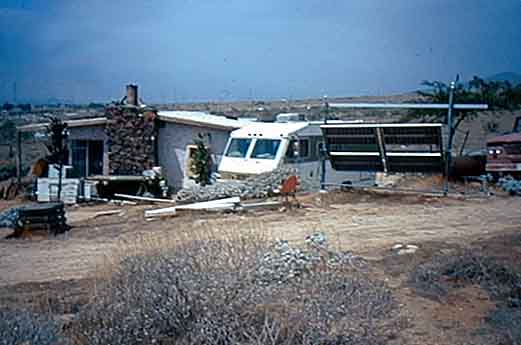
Don Middleton's Cabin
Windmills at San Gorgonio Pass
My tent pitched for the night
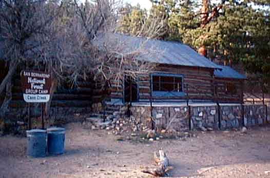
Cabin at Coon Creek where I spent the night
Looking north toward Big Bear City
Leaving Big Bear City Fire
Station
Soaking my feet in Caribou Creek
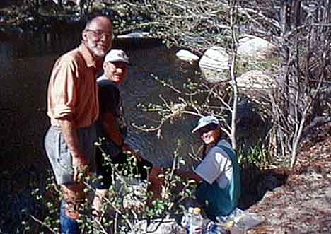
Mark, Linda and me at Deep Creek
Nude Bathing at Hot Springs
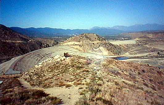
Deep Creek Flood Control Dam
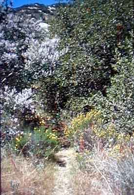
Flowers along the trail
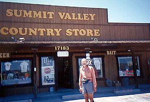
The Summit Valley Country Store
Added from scans of Allen's slides on June 28:
More windmills
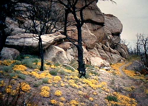
Lots of yellow flowers along the desert trail
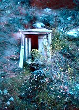
An abandoned mine entrance
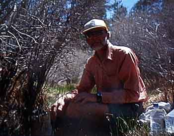
Low sun on the mountains,
with Allen's campsite in the foreground
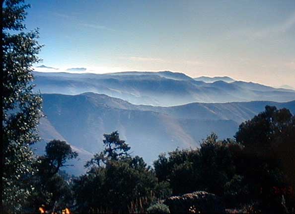
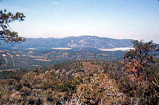
A beautiful shot of mountains in the distance
Trees coated with ice
Added from scans of Allen's slides on July 16:
A panoramic view of the
much-mentioned Kennedy Meadows
The Kennedy Meadows General Store
![]()
![]()
![]()