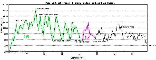
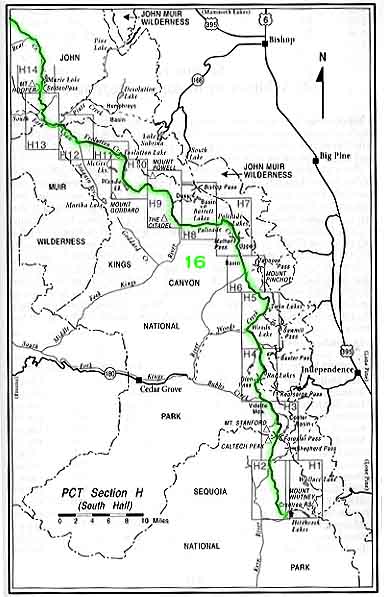
Installment #16 - June 25, 1999 - Into the High Sierras
I'm at Red's Meadow, which is just about exactly 900 miles into the trip, so I'm more than a third of the way, and 200 miles into the Sierras! The major challenges I'm finding with the Sierras are elevation, snow, water, and mosquitoes. Mostly not all at the same time.
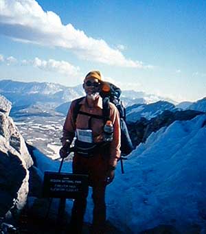
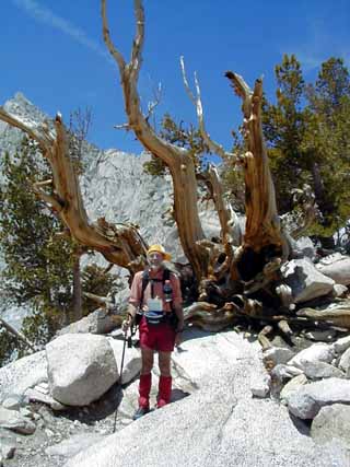
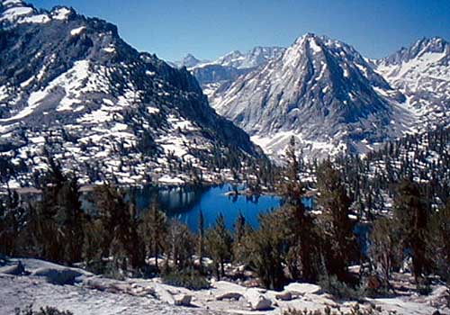
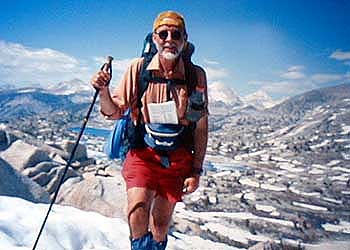
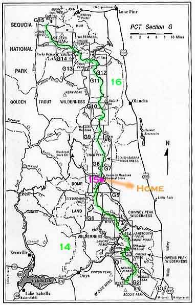
The main events are the passes. The first pass was Forester, a 13000-foot pass [the highest point on the whole PCT, as you can see on the new elevation map]. Here are some shots of me at the top of Forester Pass and looking back at Forester Pass. And then came Kersarge Pass. Kersarge Pass is not on the trail - I went over it to retrieve my food stash, the one that Dave Porter and I had put in before I started. That day, after going over Kersarge in both directions, I did the first 12000-foot pass. We've done a total of four 12000-foot passes, followed by two 11000-foot passes. Here are a couple of shots of Bullfrog Lake, on the trail to Kersarge Pass and Bullfrog Lake again, on the way back.
The passes are the main events because they're generally the highest elevation that we get to. To hike a typical pass, you go up a trail that gets steeper and steeper, and then as you get into higher elevations there'll be a patch of snow on the trail, and then a bigger patch of snow on the trail, and then one big enough so that you lose the trail - where the heck did the trail go? You roam around a little bit and find it. After a while, you get into more and more snow and you give up trying to follow the trail itself and just follow the general route. And then coming down the pass, since we're typically going south to north, we're coming down the north side of the pass, which gets less sun and there's even more snow.
Here are some shots of me at Muir Hut - a stone building at the top of Muir Pass, a pretty mountain and lake, me at the top of Seldin Pass, and looking down at the Marie Lakes from Seldin Pass.
Elevation - I'm carrying a much heavier pack than I was carrying during the first part of the trip - I'm carrying a bear canister, the ice axe, a heavier sleeping bag, heavier foul-weather gear. I was carrying my boots, but I've sent them home again - I'm back to just sneakers and sandals. [So how are your blisters?] No blisters since I got back on the trail at Kennedy Meadows! The thing that bothers me in the higher elevations is breathing. The straps on my pack seem to limit my lungs, and I have a tougher time going up hills in the higher elevations.
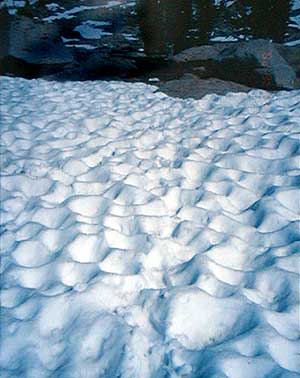
Snow - One of the big problems with the snow is that the warmth of the rocks will melt the snow out underneath and make it soft. So as you're going along on the surface of the snow and you get close to a rock, you "posthole" - your foot goes down through the snow, sometimes to the point that you end up sitting on the ground with one leg bent up under you and the other one down in this hole. The fear, of course, is that you end up with your foot jammed between a couple of rocks or something. I've only had a couple of really bad postholes. With one of them, the reason that the snow was soft was that there was a brook traveling underneath, and I ended up with my foot in the water and I couldn't get it out - I guess I must have gone through toe-first and I had to dig myself out. In addition to the posthole problem, it's a bit of a challenge - and a thrill - going across an ice field or a snow field, where the snow is at a 45-degree angle and goes down a few hundred feet below you. You walk across it in steps that you're making, that sometimes collapse. You know that if you slip you can go downhill quite a ways, and that's where the ice axe comes in handy. You always stick it into the snow or ice above you and use it as a handle. Then there are sun cups - areas of snow melted by the sun to form this very rough surface full of holes, kind of hard to walk across
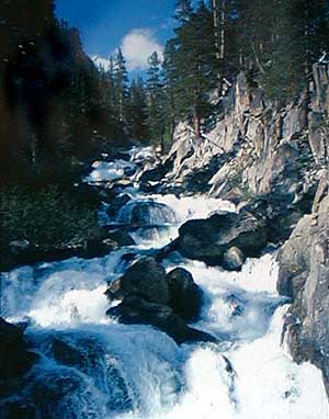
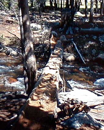
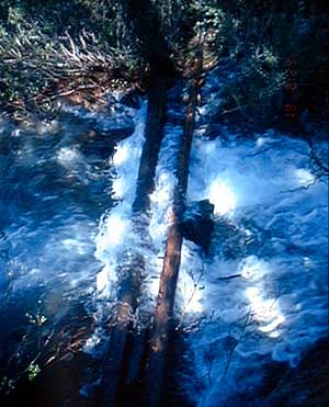
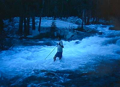
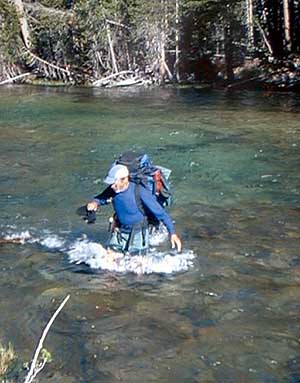
Water - stream crossings, that is. Some of the worst streams have bridges, which is great. With some, you can find a log, either one someone has stuck there or one that has fallen naturally to get you across the stream. A lot of the streams have rocks that you can use to step across, but the streams are so high that a lot of the rocks are under water. When none of those things work, then you have to wade across. Sometimes, that just means getting your feet wet. But other times it means thigh-deep water that's fast-moving, and those are the ones that are potentially dangerous - you have to be careful about where you place your feet. Another hazard is that some of those streams are so damned cold that you start to ache and you're dying to get out of that water, and you tend to be a little more careless and you shouldn't be. They teach you that, to cross a stream, you stop, take off your shoes, put on your sandals or whatever you're going to use to cross the stream, make the crossing, take off your sandals, dry your feet, put on your shoes, and carry on. I did that the first couple of crossings, but then eventually decided the heck with it. It takes so much time, and there are so many of those crossings, that I just go through with my sneakers on. So my feet are wet most of the time. On the other side of a stream, I'll tip my feet up to drain out most of the water, and continue on. Here's a shot of Jim Fording Evolution Creek, one of the hairier fiords. As soon as I finished it, I turned around to take a picture of the guy behind me, but it was Nick, who is 6'9" tall. So Nick was wading across it in water that was up to his knees, and it didn't look dramatic at all, so I didn't take any pictures of Nick - just Jim, who is more my size.
Mosquitoes - The mosquitoes come at the lower elevations. There have been a couple of nights when they were really terrible - long pants, gloves, and a mosquito net over my head. You get to where you're going to stop, pitch the tent, and get inside. Then you struggle to get things set up inside a teeny-weeny tent with me and my pack in there - but at least no mosquitoes.
Despite all of the above, it really isn't bad. The weather is nice - it's usually sunny, too warm at low altitudes but pleasantly cool at higher altitudes. [Yes, I can see I was wrong, I really wish I was along with Allen.]
Rebecca Williams, who started with us back on the 17th, was apparently trying to do a stream crossing by boulder-hopping but slipped and badly twisted her ankle. I passed her a few days ago holed up in a tent. She was looking for something to read, so I ripped my book in half, gave her the first half, and promised to mail the rest of it ahead to one of her resupply locations. So hopefully she'll get the rest of it, but even if she doesn't, the book wasn't that good.
I ran into Walt and Pat [the Happy Trails couple] in Vermilion Valley a few days ago, and they reported that Rob Bedichek had just been there. Rob's girlfriend Annie had come down to meet him there. Just before Rob left to hit the trail again, he and Annie rented a canoe and went for a canoe ride. When they came back in, they were engaged! [Another one of the many perils of hiking the PCT.]
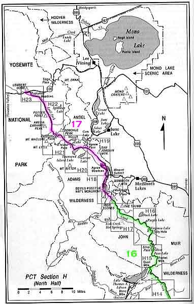
A couple of days ago, I stopped at the Vermilion Valley Resort on Lake Edison. They have a ferry service, where they pick you up at one end of Lake Edison and take you to the Resort. They have a tent for through-hikers, and they give you the first night free and your first drink is free - they're very nice people, a very nice place. I left there yesterday morning and I'm about 30 miles beyond there, and about a day ahead of schedule. The next stopping spot will be Tuolumne Meadows, where I'll pick up one of the stashes that Dave Porter and I left, and that should be probably Sunday.
Allen
Allen covered a lot of territory since the last report - he finished the second half of Chapter G and is two thirds of the way through Chapter H, which is a large chapter and is divided between a southern part and a northern part. More impressive still is the range of elevations that he's traversed!
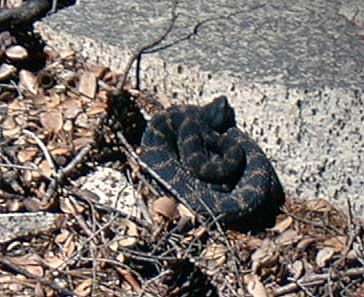
Allen's fifth set of slides arrived. You know the ropes - the newly added photos are linked in where they belong in previous installments, but can also be found right here. Allen had sent shots of rattlesnakes in the past, but this is the first time he actually got close enough that you could tell what it was in the picture.
Dave
Added from scans of Allen's slides on June 25:
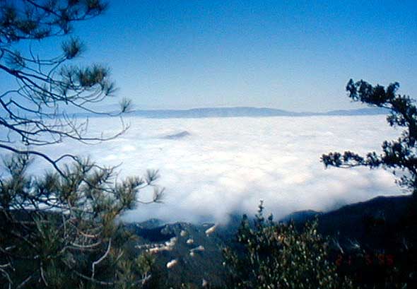
A beautiful shot looking down on the tops of clouds
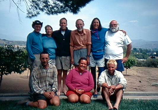
A group portrait of Allen and his fellow hikers
Up close and personal with a rattlesnake
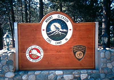
Fire Camp sign at the end of a wrong turn
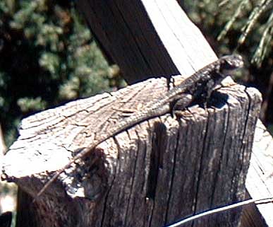
A lizard sunning hizelf on a post
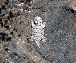
A turtle-shaped lizard - fairly common
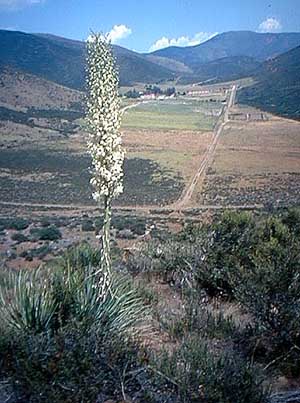
A yucca plant with a scenic background
Added from Dave Porter's digital camera shots on July 9:
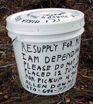
A food cache bucket
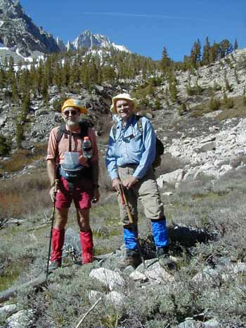
Allen on the Kersarge Pass trail - looks like a
moonscape
Allen and Dave Porter on the Kersarge Pass Trail
Added from scans of Allen's slides on July 16:
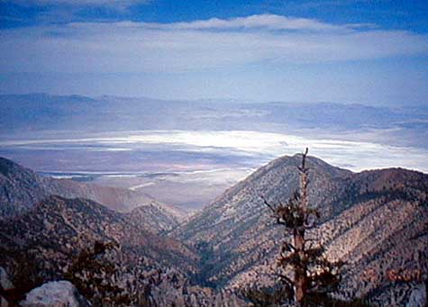
Looking east through gaps in mountains toward Owens dry
lake
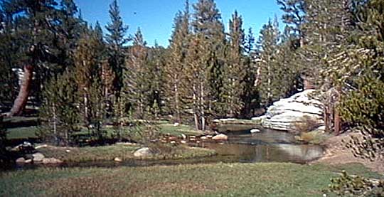
A natural bridge - one of the easier stream crossings
Another gentle stream - hey, this is easy!
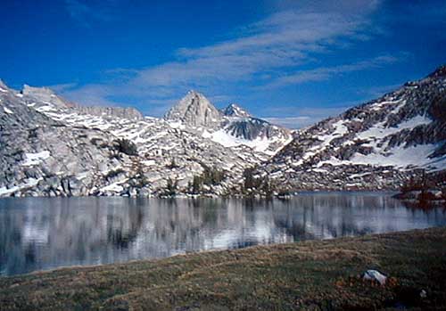
Forester Pass
Added from scans of Allen's slides on September 6:
Allen at the top of
Forester Pass
Looking back at Forester Pass
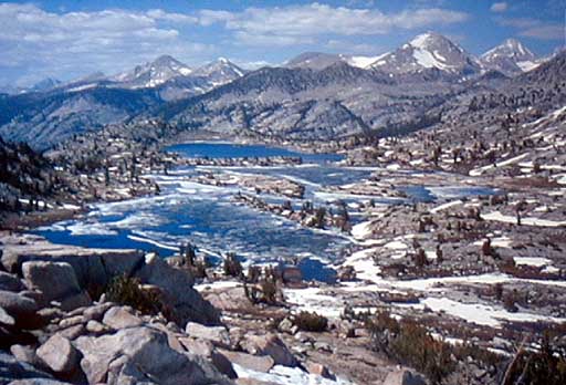
Bullfrog Lake, on trail to Kersarge Pass
Bullfrog Lake again, on the way back
Allen at Muir Hut, a stone building at the
top of Muir Pass
A pretty mountain and lake
Allen at the top of Seldin Pass
Looking down at the Marie Lakes from Seldin Pass
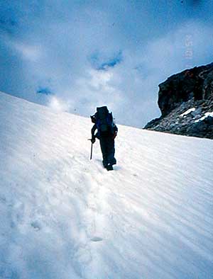
"Anybody seen a trail marker recently"
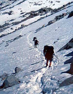
Hikers in snow descending from Forester Pass
Sun cups
Looking upstream at Fish Creek
Stream between the first and second Ray Lakes
An easier crossing, with a wooden bridge
A golfer attempting to avoid a two-stroke penalty
Jim Fording Evolution Creek
Jim in front of the Hikers' tent at Vermilion Valley
Resort
![]()
![]()
![]()